
Beacon’s Beach / Oil Piers
Beacons Beach: The new name for an old beach that already had a name.
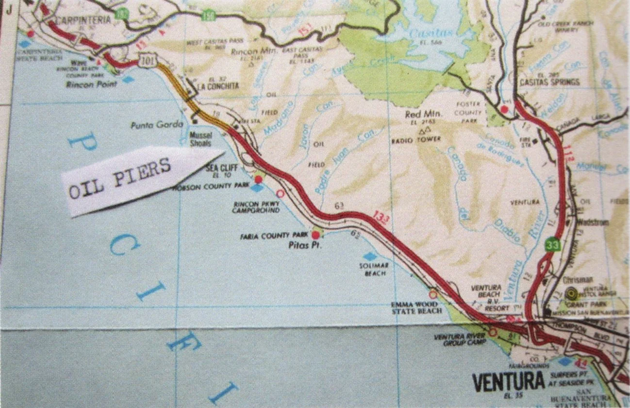
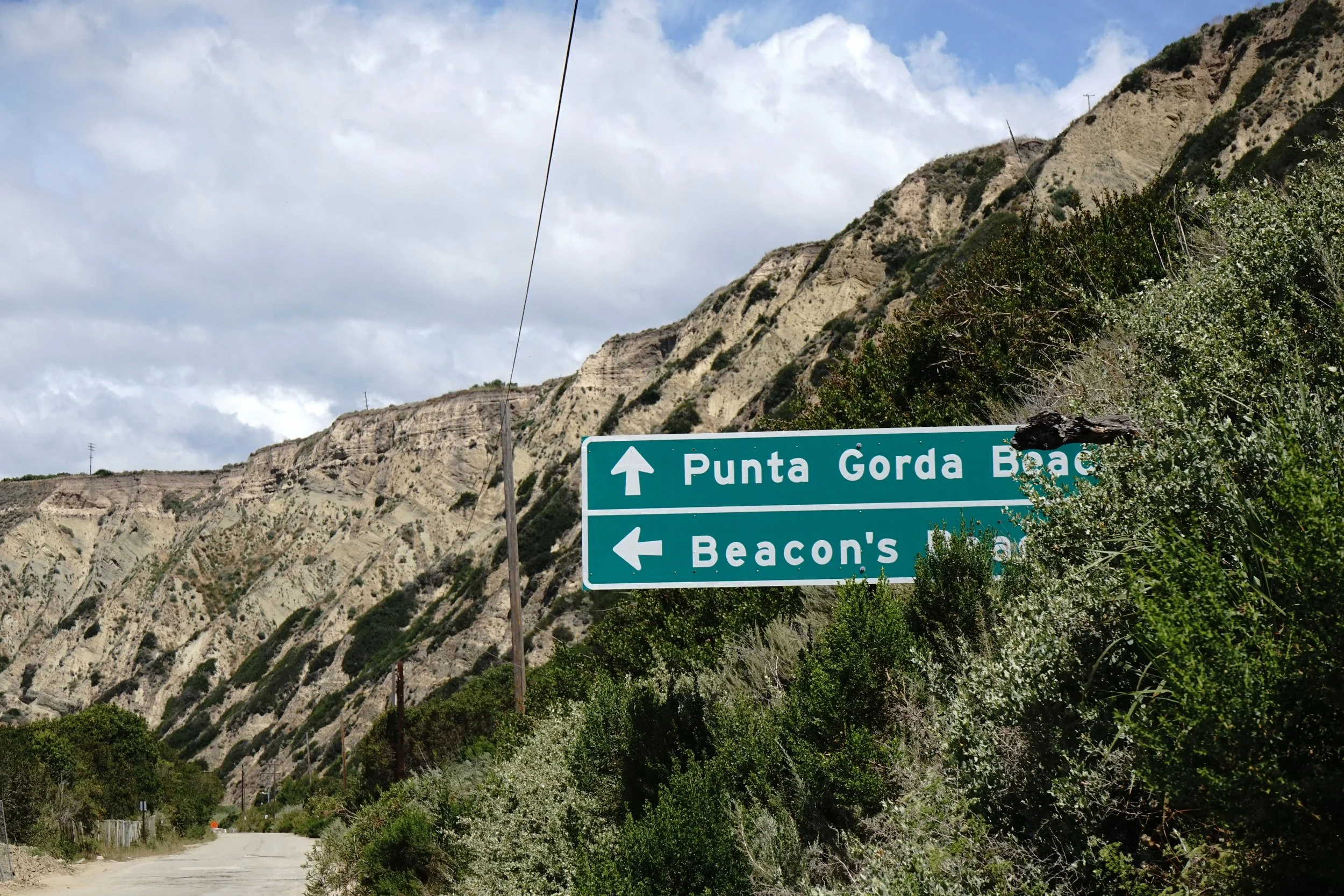
If you’ve driven along Rincon lately, just north of the fire station, you’ve probably seen them: the new signs. Brand new, clean, official, easy to miss if you’re not looking for them.
One arrow points left: Beacon’s Beach.
Straight ahead: Punta Gorda.
And if you’ve spent any time here, you might find yourself asking a simple question: What happened to Oil Piers?
Punta Gorda makes sense. It’s a name with history - the current day La Conchita. "Punta Gorda” is Spanish for massive point. The area includes layers and layers of stories of trade, stagecoach, and railroad travel. The city of Punta was home to families in agriculture and oil, and even had a schoolhouse and a post office.
“Beacon’s Beach,” though, sounds like it should have a story too. Something buried. Something old. I was excited to dig in. And guess what, the story is not what I expected. To get the big picture, let's go back to what this stretch of coast actually was.
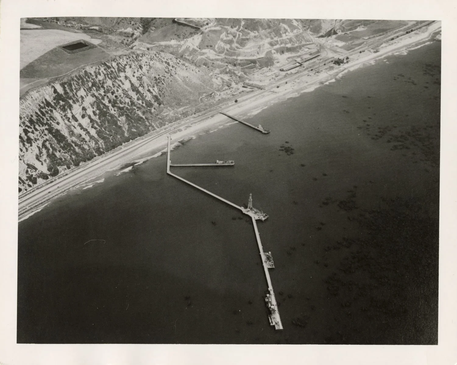
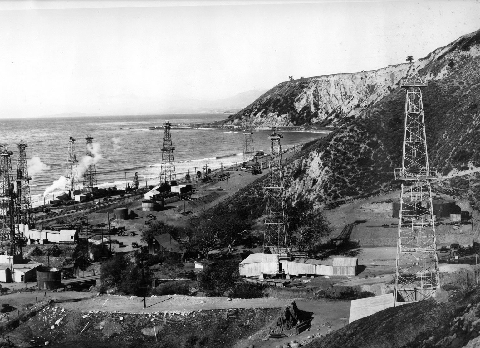
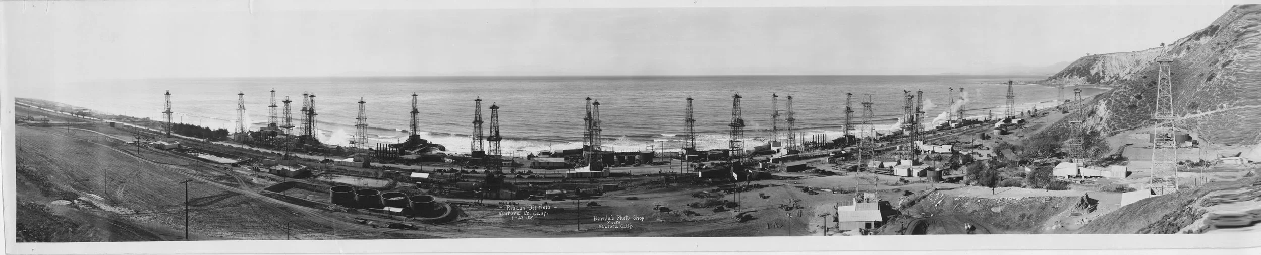
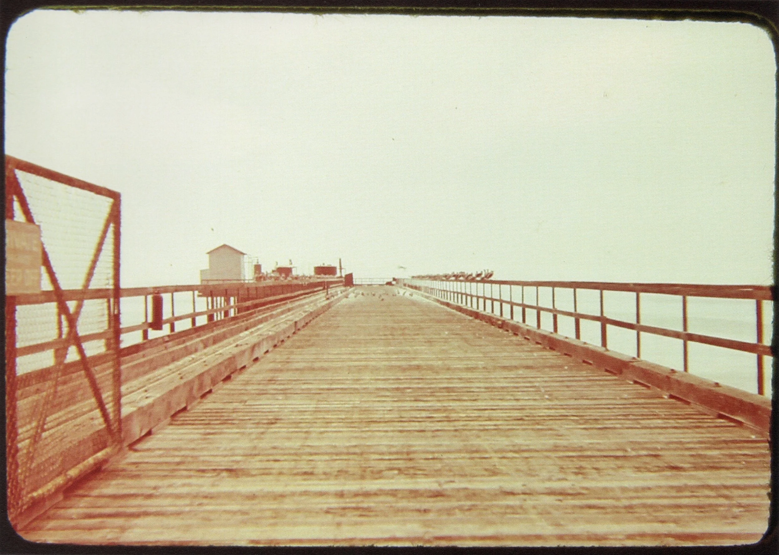
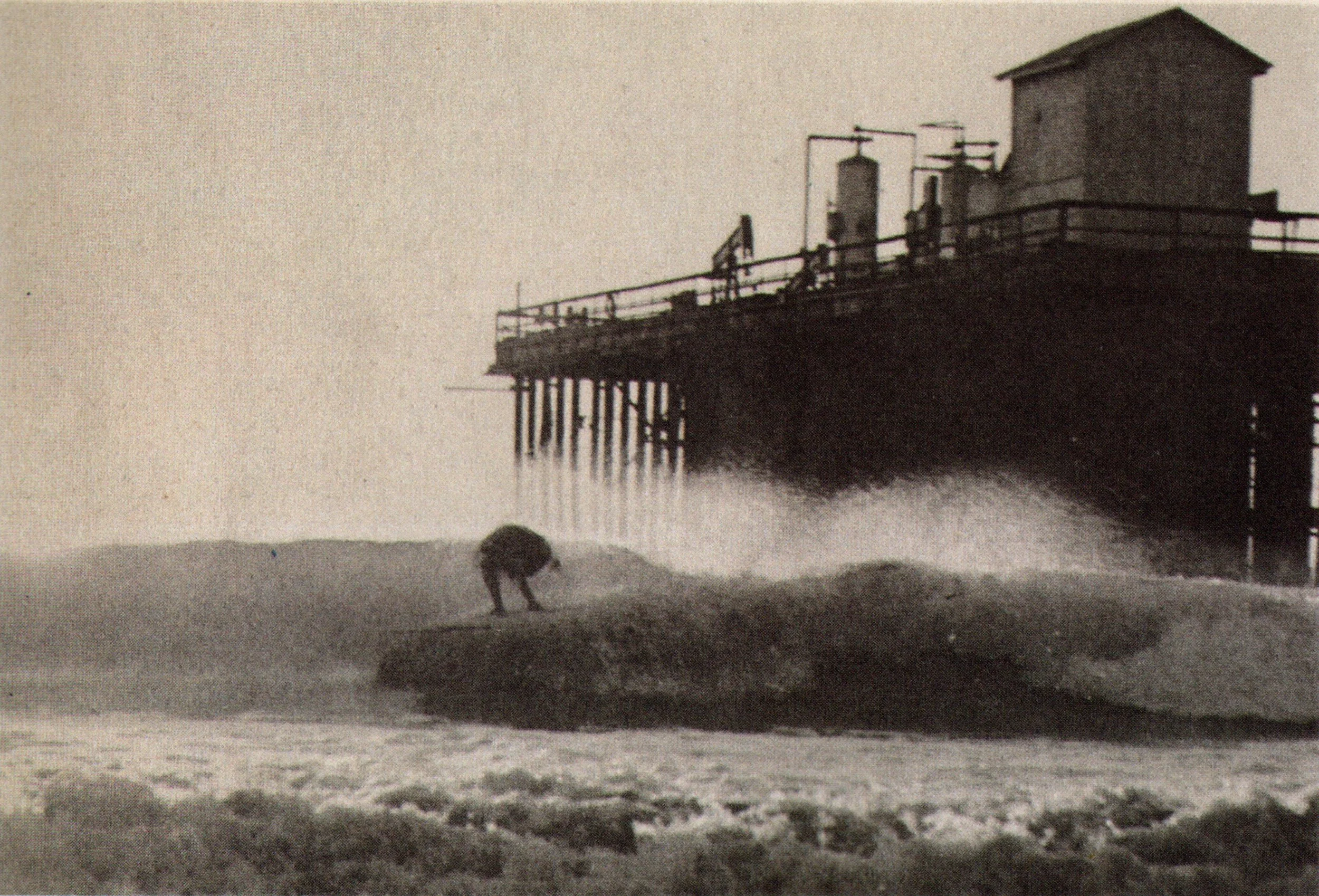
The Rincon field was discovered in December 1927, during the tail end of the California oil boom. The Pan American Petroleum Company drilled on a stretch of coast owned by Abram Lincoln Hobson, "Father of the Oil Field”, a pioneer cattleman and developer. They also constructed multiple wooden piers off the Hobson coast. At first, there were 3. The shortest pier was around 200 feet long, and the middle pier was 350 feet long. The longer one extended 2,170 feet from the beach, with a 620-foot “spur” jutting off to one side.
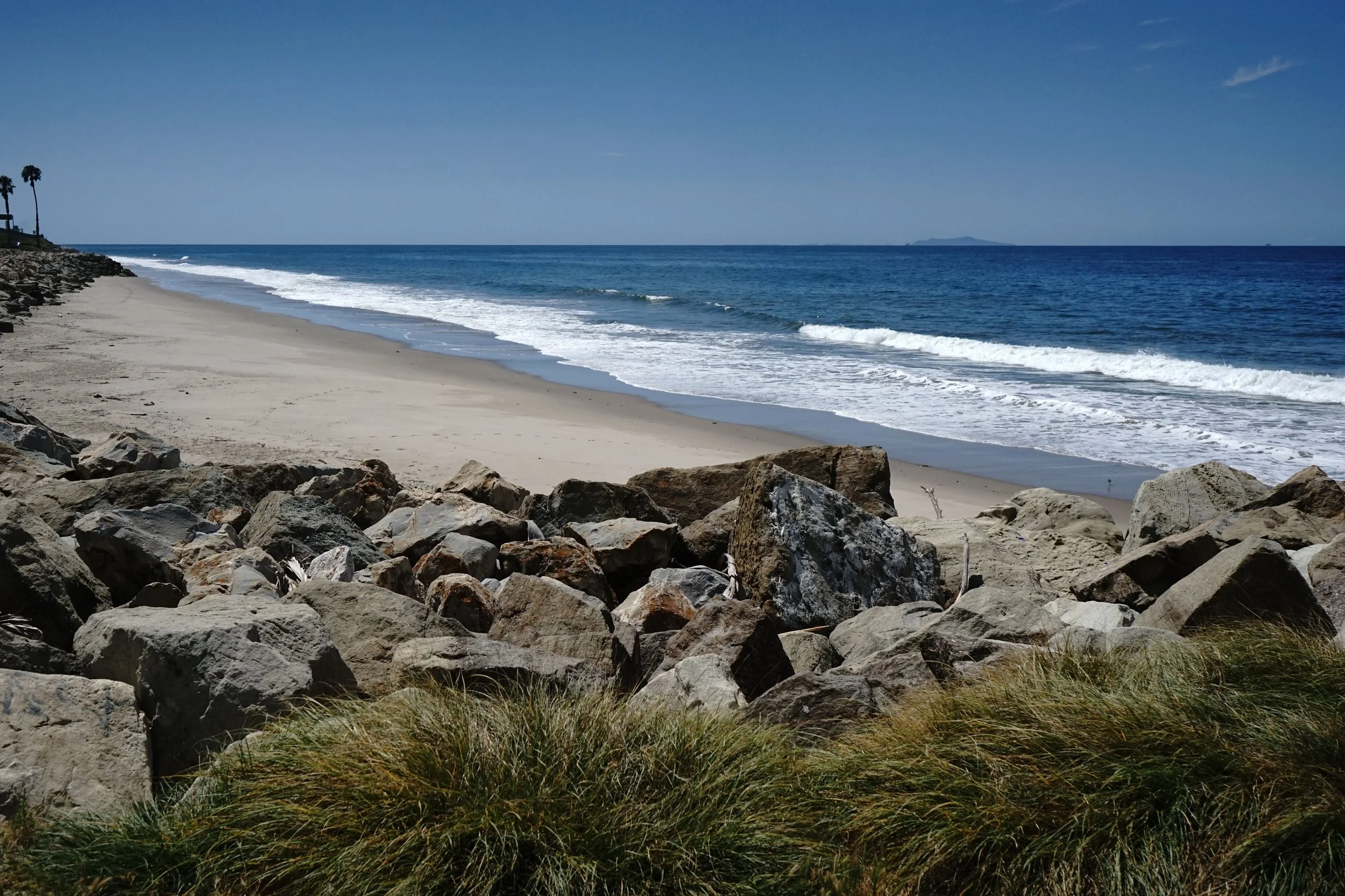
As the North Ventura coast developed with the Rincon causeway, then the paved Rincon road, Summer cabins and roadside cafes, surf and beach culture followed. Ventura had its many options of points, reefs, rivermouths, peaky beach breaks. And to the North, a stretch of sand that became known simply known as: Oil Piers.
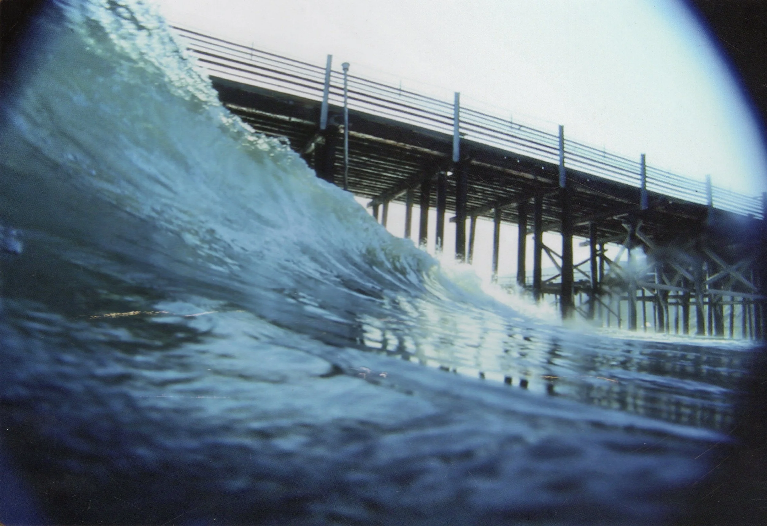
As early as the 1950s, surfers adopted the name as a break, and by the 1980s, it was a widely recognized surf spot. There were now 2 piers, with multiple take-off spots off both piers, rights and lefts. It picked up any little bit of wind swell, but miraculously was sheltered from the wind. Glassy waves rumbled through the pilings. Sandy bottom, sandy beach, drawing in the culture, surfing or not.


Little did the Oil Piers crowd know, Mobil had stopped pumping the pier rigs after deciding extraction was no longer economically viable. By 1994, all 37 wells connected to the piers had been plugged and abandoned. The end was near.
Mobil cited its original lease agreement from the 1920s, which required the cleanup of piers and wells once operations ended. But the proposal sparked immediate concern.
Surfers worried about losing a surf break shaped by the structures. The pier and hundreds of pilings were collecting sand that would be whisked away, and the peeling waves would disappear with it. Environmentalists raised questions about sand retention and the ecosystems that had formed around the structures. Locals pushed back against the idea of erasing something that had become part of the coastline’s identity.
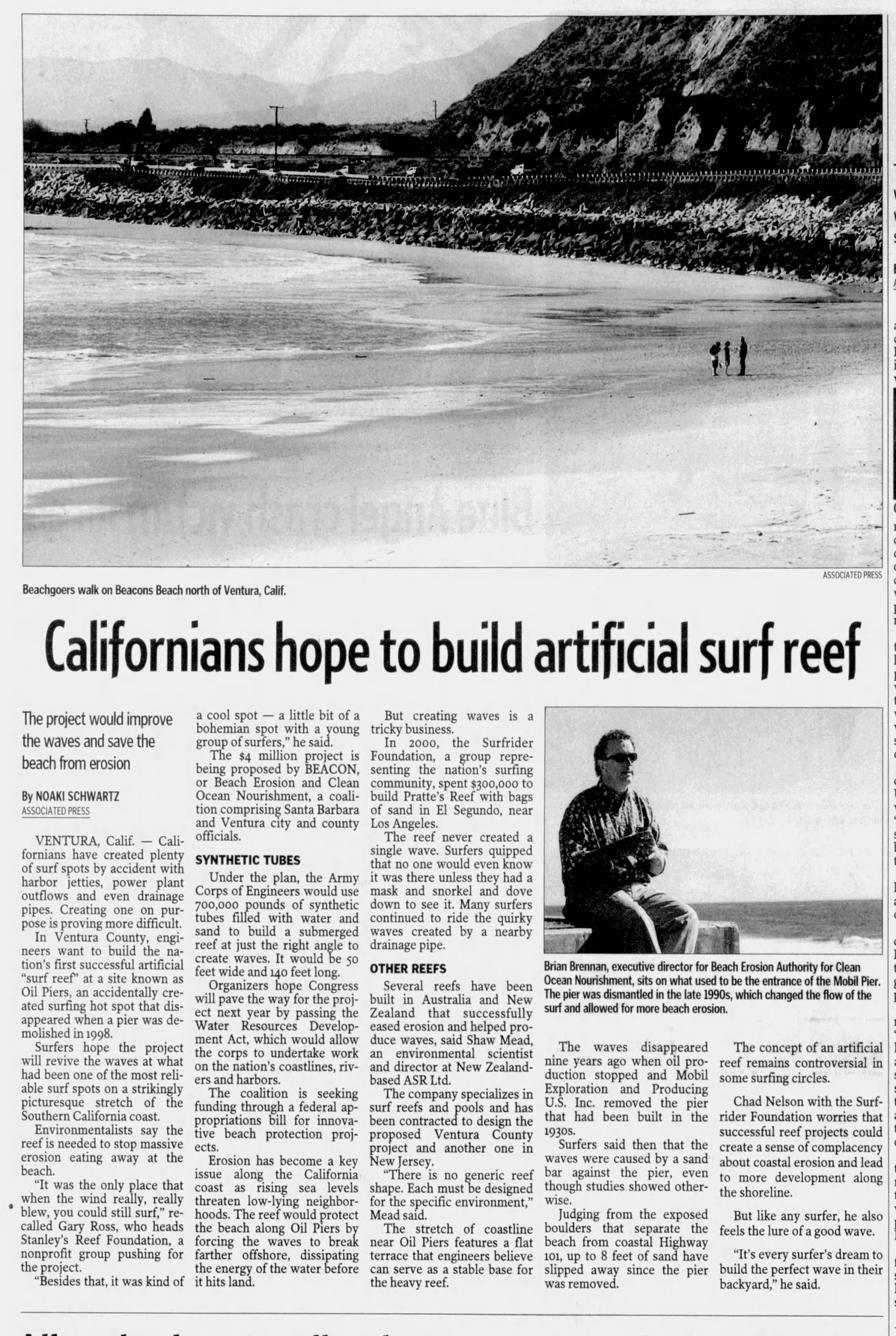
A State Lands Commission study ultimately concluded that removing the piers would not significantly impact wave quality or sediment movement. So the piers came out in 1998.
Environmental groups stepped in with a solution. An artificial reef. In 2002, the Beach Erosion Authority for Clean Oceans and Nourishment (BEACON) agency, working with the U.S. Army Corps of Engineers, proposed an artificial reef at the former Oil Piers site. The next 5 years resulted in plans to build the nation’s first successful artificial “surf reef”. It was environmentally backed because the reef was designed to slow the massive erosion at the beach.
The $4 million project was proposed by BEACON. What followed wasn’t dramatic. The project quietly faded out by 2007 and was replaced by County plans for parking improvements and coastal access upgrades. In 2010, those plans appeared in the California Coastal Commission and Ventura County documents.
And within them, almost casually, a new name surfaced:
Beacon’s Beach.
No explanation. No origin story. No recognition of what came before. Just a name, printed as if it had always been there.
The name “Oil Piers” was a direct reference to the structures that shaped both the shoreline and the culture around them. It was a name that came from use, from repetition, from people showing up every day for years.
“Beacon’s Beach” might sound nicer. Cleaner. Easier to put on a sign. But it doesn’t tell you anything about the place. So maybe this is nitpicky. Or maybe it’s just noticing how easily a name and its history can slip away.
And I can’t help but wonder why, when given the chance, no one thought to keep it.
-Shannon Kenny, 5/5/2026